
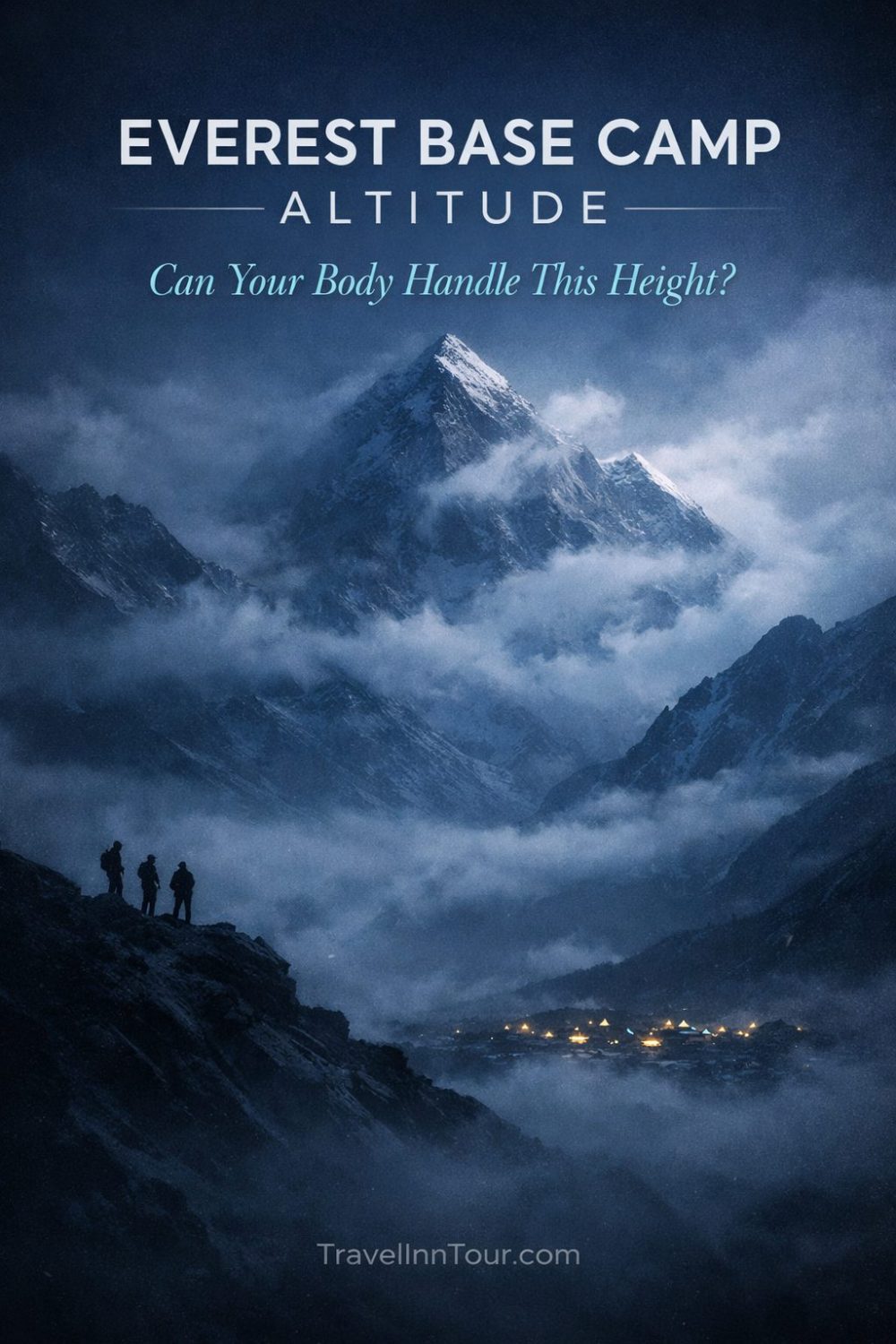
Just how high is Everest Base Camp? This guide tells you the official elevation (5,364 m / 17,598 ft), explains what that altitude means for your trek, outlines acclimatization and safety tips, and helps you plan logistics so you reach EBC confidently.
Understanding Everest Base Camp Elevation
What is Everest Base Camp?
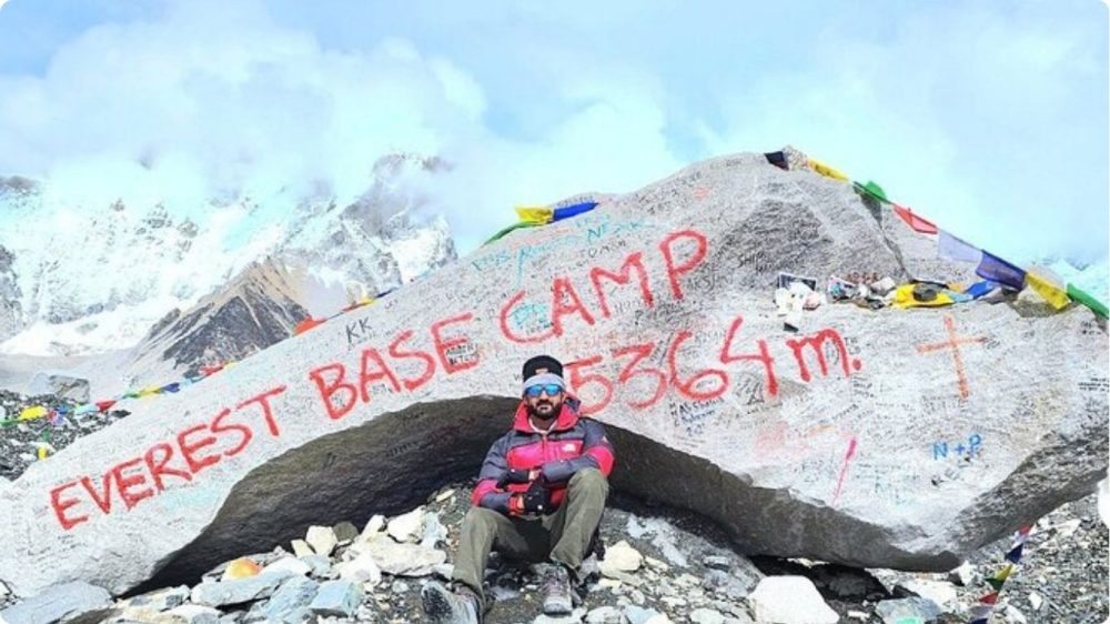
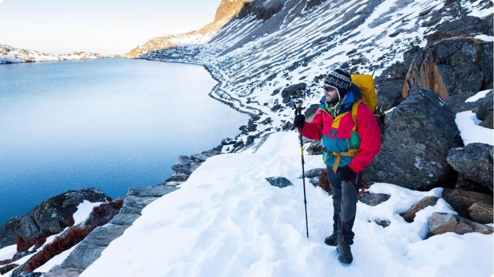
You’ll reach the South Base Camp on the Khumbu Glacier at 5,364 m (17,598 ft), a seasonal hub of tents, teahouses and expedition gear that acts as the staging area for climbers and the final high point for most trekkers rather than a permanent settlement.
Importance of Elevation in Trekking
Your ability to complete the EBC trek hinges on how you handle elevation: at 5,364 m the air contains far less oxygen, so pacing, planned acclimatization days (for example nights in Namche at 3,440 m) and limiting daily gains-typically 300-500 m-are standard to lower altitude sickness risk and sustain performance.
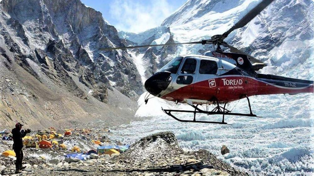
You must watch for early AMS signs like headache, nausea and dizziness and be prepared to descend if severe symptoms (confusion, ataxia) appear; rapid options such as helicopter lifts to 5,545 m or skipping acclimatization amplify risk, so follow proven protocols-sleep lower, hydrate, eat, and insert rest days within a 12-14 day itinerary.
Overview of EBC Elevation
EBC’s official elevation of 5,364 m (17,598 ft) places you well into high-altitude territory-about half of Everest’s summit-and compares with Kala Patthar at 5,644 m (18,519 ft) and the Tibetan North Base Camp at ~5,150 m (16,900 ft), all of which shape your logistical and medical planning.
Because EBC is measured from sea level on the Khumbu Glacier, your net ascent from Lukla (2,860 m) to EBC is roughly 2,504 m (8,215 ft) and to Kala Patthar about 2,784 m (9,136 ft); factor those elevation gains into gear selection, daily mileage, and emergency plans since small altitude changes significantly affect sleep, appetite, and exertion.
Everest Base Camp Elevation Guide
EBC Height Explained: 5364m
At 5,364 meters above sea level, Everest Base Camp places you well into high-altitude terrain where the air thins and every step feels more demanding; this official Nepal-side elevation defines the classic trek’s endpoint and the milestone you’ll aim for on the Khumbu route.
Conversion of EBC Height to Feet: 17,598 feet
That 5,364 m equates to roughly 17,598 feet, so when you check altimeters or flight profiles you should expect that figure as the standard reference for EBC on the Nepal side.

You can use the quick reference below to compare EBC to nearby high points and planning benchmarks:Altitude Conversions
| Location | Elevation |
|---|---|
| Everest Base Camp (South, Nepal) | 5,364 m / 17,598 ft |
| Kala Patthar (viewpoint) | 5,644 m / 18,519 ft |
| Helicopter drop (typical) | 5,545 m / 18,192 ft |
| North Base Camp (Tibet) | 5,150 m / 16,900 ft |
Comparison to Other Base Camps
Compared with the North Base Camp at 5,150 m and viewpoints like Kala Patthar at 5,644 m, you’ll find EBC sits between those altitudes-higher than many trekking areas but lower than summit approaches-so your acclimatization strategy should reflect those differences.Base Camp Comparison
| Site | Notes for You |
|---|---|
| South EBC (Nepal) – 5,364 m | Primary trekking endpoint and staging area for Everest expeditions |
| North EBC (Tibet) – 5,150 m | Lower altitude and alternate access with different logistics |
| Kala Patthar – 5,644 m | Higher viewpoint offering the best Everest panorama; raises your max altitude |
| Helicopter access – ~5,545 m | Fast access that reaches slightly higher elevations than EBC |
If you plan your trek, note that even a few hundred meters of difference alters acclimatization needs and symptomatic risk, so tailor your itinerary and rest days to the specific altitudes you’ll cross to protect your progress and maximize those once-in-a-lifetime views.
Everest Base Camp Altitude for Trekking
Key Trekking Trails to EBC
You’ll most often follow the classic Lukla-Namche-Tengboche route that takes you from Lukla (2,860m) up to Everest Base Camp (5,364m) via Dingboche and Gorak Shep, but alternatives include the Gokyo Lakes circuit with the Cho La pass (~5,420m) and the demanding Three Passes route; helicopter transfers to EBC or Kala Patthar (5,644m) provide a high-altitude experience without the full trek.

Elevation Changes During the Trek
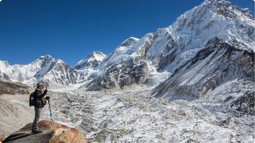
Expect steady altitude gains: many itineraries climb roughly 300-600m on walking days, with planned acclimatization stops-Namche Bazaar (3,440m) and Dingboche (4,410m) are common-before reaching EBC at 5,364m; Kala Patthar at 5,644m raises your maximum altitude further.
Typical day-by-day profiles start at Lukla (2,860m), drop slightly to Phakding (~2,600m), then rise to Namche (3,440m) where you’ll often take an acclimatization day; subsequent stages move through Tengboche (3,860m), Dingboche (4,410m), Lobuche (4,940m) and Gorak Shep (5,164m) before the final push to EBC. You’ll gain about 2,500-2,800m total from Lukla to Kala Patthar, so plan itineraries of 12-14+ days, follow the common guideline of not gaining more than ~300-500m per day above 3,000m, and build recovery days to reduce the risk of altitude illness while you adjust to thinner air and colder temperatures.
Recommended Trekking Routes
If this is your first EBC trek you’ll likely choose the classic 12-14 day Lukla itinerary for reliable teahouse infrastructure; the Gokyo Lakes route (14-16 days) rewards you with alpine lakes and another Everest viewpoint, while the Three Passes (18-21 days) suits experienced trekkers seeking technical passes and bigger altitude exposure.
Weigh trade-offs: the classic route gives better acclimatization and more village culture, Gokyo adds lake scenery and a cleaner skyline of Everest, and Three Passes (Kongma La ~5,535m, Cho La ~5,420m, Renjo La ~5,360m) demands higher fitness, route-finding and sometimes crampons/rope skills. Helicopter options cut travel time-flights to EBC/Kala Patthar reach 5,545-5,644m-but cost more and reduce time spent collecting the kind of stories you’ll recount for years. Secure TIMS and Sagarmatha National Park permits and build flexibility for weather or Lukla flight delays into your plan.
The South Base Camp of Mount Everest
Understanding South Base Camp Height (Nepal)
At 5,364 meters (17,598 feet) on the Khumbu Glacier, the South Base Camp is the classic endpoint for trekkers, and you’ll feel the thin air immediately. As you reach this spot after days of ascent from Lukla, your achievement becomes part of a travel tale you’ll share for years, proof that you dared to leave familiar comforts and stand more than 5.3 km above sea level.
North Base Camp Elevation in Tibet
The North Base Camp sits at about 5,150 meters (16,900 feet), making it roughly 214 meters lower than the Nepal side. If you choose the Tibetan approach, you’ll often reach higher access roads and shorter on-foot distances, so your trek looks and feels very different from the Khumbu route.
Access to the north side typically routes through Tingri and the Rongbuk area, and you’ll notice the northern face’s stark, broad profiles compared with the southeast ridge seen from Nepal. Permits, seasonal road conditions, and sometimes vehicle access change your logistics: you can combine a shorter trek with motorized transport, but your body still faces high-altitude strain and the need for careful acclimatization.
Differences in Elevation Between the Two Base Camps
The elevation gap between South (5,364 m) and North (5,150 m) is about 214 meters (698 feet), a modest but tangible difference that affects trekking style and oxygen availability. For you, that means slightly different acclimatization strategies and a different sense of remoteness depending on which side you pick.
Beyond the raw numbers, the South Base Camp requires a multi-day trek through the Khumbu Valley-so your acclimatization occurs gradually on foot-while the North often involves higher road access and shorter walking segments, changing how you prepare physically and logistically. Also consider that features like Kala Patthar (5,644 m) will push your maximum altitude higher than either base camp, which informs how you plan your ascent profile and altitude precautions.
Everest Base Camp Trek Elevation Profile
Elevation Profiles for Different Routes
You’ll encounter distinct elevation patterns: the classic Lukla-Namche-Gorak Shep route climbs from Lukla (2,860m) to Namche Bazaar (3,440m), then on to Gorak Shep (5,164m) and EBC (5,364m), with Kala Patthar topping out at 5,644m. The Gokyo variant sends you over Gokyo Ri (5,357m) and offers lower daily gains but longer distances, while the Three Passes route includes Cho La (≈5,420m) and Renjo La (≈5,360m), adding multiple 400-800m ascent days.
Charting the Trek: Elevation vs. Distance
You’ll cover roughly 65 km one-way (≈130 km round-trip) with a net ascent of about 2,504m from Lukla (2,860m) to EBC (5,364m). Typical days run 8-12 km with elevation gains of 300-700m; the steepest sections are Namche→Tengboche and Dingboche→Lobuche. Plan acclimatization walks and at least one rest day at Namche or Dingboche to keep daily gain manageable and reduce altitude risk.
Example day profiles clarify what you’ll face: Lukla→Phakding (~8 km, small net descent to ~2,650m), Phakding→Namche (~10 km, +800m), Namche acclimatization days, Namche→Tengboche (~6 km, +420m), Tengboche→Dingboche (~8 km, +550m), Dingboche→Lobuche (~6-7 km, +530m), Lobuche→Gorak Shep (~8 km, +220m) and Gorak Shep→EBC (~6 km roundtrip, +200m). Expect several short, steep segments where gain per kilometer spikes-plan pacing and hydration accordingly.
Future Trends: Elevation Profiles for 2026
You should expect modest changes in 2026: the official EBC elevation remains 5,364m, but glacier retreat and trail reroutes around unstable moraine fields can alter walking elevations and campsite positions. Trek operators increasingly rely on GNSS-based elevation data, add extra acclimatization days on standard itineraries, and offer more helicopter transfer options that land around 5,545m for quicker access.
Operationally, agencies and local authorities are updating digital elevation models and trail maps more frequently, so your pre-trip planning should include checking 2026 route notes and recent GPS tracks. Anticipate slightly longer approaches around glacier margins, revised daily gains to avoid hazardous sections, and more conservative itineraries driven by safety and changing terrain-this directly affects how you schedule rest days, pack gear, and set fitness goals.
The Kala Patthar Ascent
The Importance of Kala Patthar
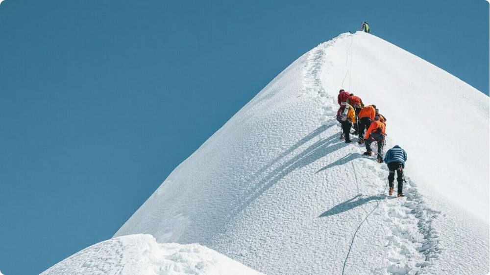
Kala Patthar is the reason you keep an extra day in your EBC itinerary: at 5,644 m (18,519 ft) it gives the clearest, unobstructed view of Everest’s summit that you won’t get from Base Camp. Standing there confirms your high-altitude achievement and lets you frame those once-in-a-lifetime photos to share the story of how far your journey took you.
Maximum Altitude and Views from Kala Patthar
At 5,644 m (18,519 ft) Kala Patthar exceeds EBC’s 5,364 m, so your maximum trek altitude usually occurs here; from Lukla (2,860 m) that’s about a 2,784 m (9,136 ft) net gain. You’ll see Everest, Lhotse, Nuptse, Pumori and Changtse in a single panorama when conditions cooperate.
Most parties climb Kala Patthar from Gorak Shep (≈5,164 m), taking 45-90 minutes up depending on fitness and conditions; you should aim for a pre-dawn start (03:30-05:00) to catch sunrise and the best visibility. Weather can change fast-clouds, wind or haze will blunt the view-so plan flexibility and bring a telephoto or smartphone zoom for summit details.
Tips for Successful Ascent
Acclimatize properly, hydrate, and sleep in Gorak Shep before attempting Kala Patthar; go slowly, use trekking poles, dress in warm layered clothing, and start very early to avoid afternoon winds. Hiring a guide or porter reduces strain and raises your chance of reaching the viewpoint comfortably.
- Schedule an extra acclimatization day (Dingboche or Gorak Shep) if you felt any altitude fatigue earlier on the trail.
- Carry 2-3 liters of water, electrolyte supplements, and snacks-your appetite and thirst change at altitude.
- Use a headlamp, spare batteries, and crampon-ready boots for pre-dawn footing on loose scree and frozen ground.
- Keep a lightweight down jacket and wind shell accessible; temperatures at the summit often drop below -10°C and wind chill is severe.
- Any severe symptoms-confusion, persistent breathlessness, or loss of coordination-require immediate descent and medical attention.
Plan your ascent window around forecasted clear mornings, and set a conservative turnaround time so you don’t push past safe limits. Many trekkers find hiring a local guide shortens decision time and improves pacing; guides also judge conditions for summit attempts and can arrange rapid descent or evacuation if necessary. Pack spare batteries for cold drains, protect electronics from condensation, and treat Kala Patthar as your highest-altitude summit attempt on the trek-not a photo stop but the culmination of careful acclimatization and pacing.
EBC Trek Height Considerations
Is EBC Height the Maximum for Trekkers?
You reach Everest Base Camp at 5,364 m (17,598 ft), but that isn’t necessarily the highest point you’ll hit on the classic route. Most trekkers include Kala Patthar (5,644 m / 18,519 ft) for the best Everest views, and some fly by helicopter to viewpoints up to 5,545 m (18,192 ft). If you start at Lukla (2,860 m / 9,383 ft), your net altitude gain to Kala Patthar can be about 2,784 m (9,136 ft), so plan accordingly.
Factors Influencing Trekkers’ Experience
Your experience on the EBC trail depends on more than trail distance: fitness level, trekking pace, itinerary length (typical treks run 12-14 days), prior high‑altitude exposure, seasonal weather, and gear all shape how you feel at 5,000+ meters. Altitude gain per day matters-keeping rises to roughly 300-500 m above 3,000 m lowers risk-while guided support, porters, and accommodation comfort also change outcomes.
- Physical fitness and cardiovascular conditioning
- Pace and planned acclimatization days (e.g., at Namche Bazaar, 3,440 m)
- Weather and season (pre‑monsoon vs post‑monsoon visibility and snow)
- Logistics: guide experience, permits, and emergency plans
- This determines whether you safely push to higher objectives like Kala Patthar (5,644 m)
If you push an 8-9 day “express” itinerary from Lukla to EBC, you raise your risk of acute mountain sickness compared with a 12-14 day schedule that adds rest and acclimatization hikes (for example, acclimatizing at Namche with a day hike to Khumjung or Everest View Hotel). You’ll notice trekkers who space climbs and include two or three slow ascent days report fewer headaches, better sleep, and higher success rates reaching Kala Patthar.
- Choose a 12-14 day itinerary rather than rushing in under 10 days
- Include acclimatization hikes and rest days at Namche (3,440 m) and Dingboche (4,410 m)
- Monitor symptoms and use a pulse oximeter or experienced guide to assess progress
- This is why many trekkers accept slower itineraries to maximize safety and summit views
Importance of Acclimatization
You must acclimatize to adapt to thinner air: Everest Base Camp sits at 5,364 m, where oxygen is significantly reduced. Schedule acclimatization days, keep daily elevation gain modest, hydrate, eat well, and sleep at lower elevations when possible. Proper acclimatization lowers the chance of moderate to severe altitude illness and increases your odds of reaching higher viewpoints like Kala Patthar.
Above about 3,000 m, aim to limit net ascent to 300-500 m per day and add a rest day every 1,000 m gained or every 3-4 days on the trail; common stops for acclimatization include Namche Bazaar (3,440 m) and Dingboche (4,410 m). If you develop persistent symptoms-severe headache, vomiting, confusion-you must descend immediately. Many trekkers use preventive strategies such as staged itineraries, light exertion on acclimatization days, and, after medical consultation, prophylactic acetazolamide (Diamox) to ease adaptation.
Risks Associated with EBC Height
Understanding Altitude Sickness
You should know acute mountain sickness (AMS) commonly starts above 2,500-3,000 m, and Everest Base Camp at 5,364 m places you firmly in the high‑altitude zone where risk rises sharply. Oxygen available at that elevation is roughly half of sea level, so your breathing, sleep and energy will be affected; many trekkers report headaches and poor sleep within the first 24-48 hours unless they acclimatize properly.
Symptoms and Prevention Strategies
Watch for early signs-headache, nausea, dizziness, fatigue and poor appetite-and slow your ascent: limit gain to 300-500 m per day above 3,000 m and build rest days every 3-4 days. You should hydrate well, avoid alcohol and heavy exertion, and discuss acetazolamide (Diamox) with a physician; typical prophylactic dosing is 125-250 mg twice daily but only under medical guidance.
For higher‑risk days, use concrete tactics: sleep lower when possible (climb high, sleep low), monitor symptoms with your guide, and carry pulse oximetry to track changes in SpO2. Practical examples include adding an extra acclimatization day at Namche Bazaar or Tengboche-both standard stops on the Lukla-EBC route-to reduce AMS incidence before you reach the 5,364 m plateau.
When to Seek Help
Seek immediate descent and medical attention if symptoms progress to severe headache unrelieved by acetaminophen, persistent vomiting, inability to walk in a straight line (ataxia), confusion or severe breathlessness at rest-these signs suggest HACE or HAPE and require urgent action. You should never push higher if such symptoms appear; continuing ascent can be life‑threatening.
Act by descending 500-1,500 m right away, administer supplemental oxygen if available, and contact your trekking operator for evacuation. If evacuation is delayed, use a portable hyperbaric (Gamow) bag while arranging transport; note that helicopter lifts from the Khumbu are possible but weather dependent and costly, so early decision‑making can be the difference between a controlled descent and an emergency rescue.
Base Camp Elevation Facts
Facts About the Actual Altitude of Everest Base Camp
You’ll stand at the officially recorded altitude of Everest Base Camp on the Nepal side: 5,364 meters (17,598 feet) above sea level. That measurement is the standard reference used by guides, maps, and trekking permits, and it marks the classic staging point on the Khumbu Glacier for climbers and trekkers alike. You should plan for thinner air and colder temperatures at this elevation compared with lower Himalayan valleys.
Differences in Base Camp Heights by Region
You may encounter different numbers depending on which side you visit: the South (Nepal) Base Camp is 5,364 m (17,598 ft), while the North (Tibet) Base Camp is about 5,150 m (16,900 ft). If you reach viewpoints or helipad sites, such as helicopter drops used for sightseeing, you can briefly be at higher spots-some landings approach 5,545 m (18,192 ft).
Those regional variations come from geography and how each camp is defined: the Nepal camp sits on the Khumbu Glacier and shifts slightly with ice movement, whereas the Tibetan camp is on a firmer moraine plateau. Survey methods also differ-Nepalese and Chinese mapping use distinct benchmarks and occasional GPS re-surveys update official figures-so the numbers you see on maps or signs can vary by a few tens of meters. When you plan logistics or acclimatization, use the locally provided elevation as your working reference.
The Significance of Base Camp Elevation
The elevation of EBC matters for your acclimatization, gear choices, and risk management: at 5,364 m you face reduced oxygen, stronger UV, and much colder nights, so your itinerary, sleeping clothing, and pacing must reflect that. This altitude also defines the trek’s prestige-reaching EBC is a milestone many travelers list as a once-in-a-lifetime achievement.
Digging deeper, the EBC elevation affects weather patterns and daily temperature swings-expect roughly a 6.5°C temperature drop per 1,000 meters gain-so you’ll experience markedly colder conditions than at Lukla (2,860 m). Your maximum altitude on a typical trek often exceeds EBC if you climb Kala Patthar (5,644 m), increasing acclimatization needs; the net gain from Lukla to Kala Patthar is about 2,784 m (9,136 ft). Use those figures when planning rest days, hydration strategy, and emergency evacuation options so your journey is both rewarding and safe.
Pros and Cons of Trekking to EBC
| Pros | Cons |
|---|---|
| Iconic altitude: you reach Everest Base Camp at 5,364 m (17,598 ft), a genuine high‑altitude milestone. | Altitude sickness risk: acute mountain sickness (AMS), and in rare cases HAPE or HACE, can occur above 3,000 m. |
| Unmatched panoramas: Kala Patthar (5,644 m) gives the most famous Everest views accessible to trekkers. | Physical demand: typical net gain from Lukla (2,860 m) to Kala Patthar is ~2,784 m (9,136 ft), requiring fitness and stamina. |
| Rich culture: you visit Sherpa villages, monasteries (e.g., Tengboche), and local festivals along the Khumbu Valley. | Basic comforts: teahouse accommodation is rustic-limited hot water, shared toilets, and simple food at high prices. |
| Personal achievement: the trek is a powerful, once‑in‑a‑lifetime story you’ll recount for years. | Weather variability: high winds, sudden snow, and sub‑zero nights can shorten seasons and force itinerary changes. |
| Accessible logistics: Lukla flights and established teahouse routes make EBC more reachable than many 5,000+m peaks. | Evacuation limits: helicopter rescue exists but is expensive and weather‑dependent; remote locations slow emergency response. |
| Training value: preparing for EBC builds endurance and high‑altitude experience useful for future climbs. | Crowds in peak months: pre‑ and post‑monsoon seasons see hundreds of trekkers, affecting solitude and teahouse availability. |
| Flexible options: you can add acclimatization days, side trips (e.g., Gokyo Lakes), or opt for a helicopter transfer to reduce exposure. | Environmental impact: increased foot traffic raises waste and trail erosion concerns in the Khumbu region. |
| Clear milestones: daily elevation profile (e.g., Namche 3,440 m) helps you plan acclimatization and goals. | Cost variability: permit fees (Sagarmatha NP, TIMS), guide/porter, and seasonal flights can make budgeting tricky. |
Advantages of Experiencing EBC
You reach a genuine high‑altitude landmark-EBC at 5,364 m-where panoramic vistas, Sherpa culture, and the Kala Patthar viewpoint (5,644 m) converge into a powerful, memorable achievement; the multi‑day trek (commonly 12-14 days) also pushes your fitness, offers unique photographic opportunities, and rewards you with travel tales few can match.
Challenges Associated with High Altitude
You face physiological stress from thinner air: oxygen levels drop significantly at 5,364 m, making symptoms like headache, nausea, dizziness, and fatigue common if ascent and acclimatization are mishandled.
On a physiological level, barometric pressure and partial oxygen pressure fall with elevation, so your arterial oxygen saturation at EBC often sits around roughly 70-80%, depending on individual adaptation. You must plan staged ascents (limit net daily gain above 3,000 m to ~300-500 m when possible), include rest/acclimatization days (e.g., at Namche Bazaar, 3,440 m), and monitor symptoms with a pulse oximeter. Medical options include acetazolamide prophylaxis, carrying supplemental oxygen or dexamethasone for severe cases, and having an evacuation plan-descent remains the definitive treatment for worsening AMS, HAPE, or HACE.
Weighing Risks vs. Rewards
You balance a once‑in‑a‑lifetime payoff-epic views, cultural immersion, and a deep personal milestone-against real risks: altitude illness, variable weather, and logistical costs; your decision should hinge on fitness, time, budget, and willingness to follow a conservative acclimatization plan.
Practically, mitigate risk by training for several months (cardio, hiking with load), choosing a longer itinerary that spaces altitude gain, hiring an experienced guide, and purchasing evacuation insurance that covers helicopter rescue. Pick shoulder seasons (pre/post‑monsoon) to reduce crowding and bad weather, and carry a basic medical kit plus a pulse oximeter. If you prioritize safety or have limited time, consider a helicopter option to minimize days at altitude-if you seek the full story‑worthy adventure and accept the preparation demands, the rewards often outweigh the risks for well‑prepared trekkers.
Essential Tips for Trekkers
- Check permits (TIMS, Sagarmatha National Park) and confirm your Lukla flight early to avoid delays.
- Plan at least 11-14 days for a standard EBC itinerary to allow proper acclimatization and contingencies.
- Train with loaded hikes and stair sessions to prepare for a net altitude gain of roughly 2,784m from Lukla to Kala Patthar.
- Any unresolved logistics, medical checks, or equipment gaps can force you to turn back before reaching EBC.
Preparing for Everest Base Camp Trek
You should build 8-12 weeks of targeted fitness: aerobic base (running, cycling), long hikes with a 10-12 kg pack, and stair-climbing sessions simulating daily gains of 500-900m. Start core and leg strength work (squats, lunges) and include 1-2 back-to-back long hikes per week. Factor in travel days to and from Lukla (2,860m) and plan acclimatization stops at Namche (3,440m) and Dingboche (4,410m) before pushing to EBC (5,364m).
Gear and Equipment Recommendations
Your pack should be 40-60L with total carried weight under 12 kg. Prioritize a down jacket (800-fill or equivalent), a sleeping bag rated to −20°C, waterproof insulated boots, trekking poles, a headlamp with spare batteries, sunglasses (UV 4/glacier), SPF 50+ sunscreen, and a reliable water-purification method.
Layering wins at altitude: use moisture-wicking base layers, a fleece or synthetic mid-layer, and a breathable waterproof shell. Break in boots over 100-150 km before departure and bring gaiters for snow and mud. Consider renting bulky items in Kathmandu or Namche (down jacket, sleeping bag) to reduce transport hassle; carry spare battery packs or a small solar charger for electronics and a compact repair kit for boots and poles.
Health and Safety Tips
Monitor your ascent: limit sleep elevation gain to 300-500m above 3,000m and include rest/acclimatization days every 3-4 days. Stay hydrated (3-4 L/day), eat 2,500-3,500 kcal depending on exertion, and track symptoms of AMS: headache, nausea, dizziness, or decreased coordination. Consult a physician about acetazolamide (Diamox) and carry a basic first-aid kit plus a pulse oximeter.
Carry emergency insurance with high-altitude evacuation cover and register your itinerary with your operator; know helicopter medevac options from Pheriche/ Gorakshep. Use a pulse oximeter to check SpO2-expect 70-85% near EBC and act on sudden drops. Maintain strict hygiene to limit GI illness and avoid alcohol while acclimatizing.
- If you develop a persistent headache or nausea, halt your ascent and rest for 24 hours.
- If symptoms worsen (severe breathlessness, ataxia, confusion), descend immediately 500-1,000m and seek medical help.
- After initial descent and medical assessment, do not continue uphill without professional clearance.
- Purchase comprehensive travel and helicopter-evacuation insurance that explicitly covers trekking above 5,000m.
- Carry photocopies of your passport, permits, insurance, and emergency contact numbers in both digital and printed form.
- After arranging insurance and evacuation plans, store documents in an easily accessible place and share copies with your guide and a trusted contact at home.
Frequently Asked Questions
Common Inquiries About EBC Elevation
You’ll reach Everest Base Camp at 5,364 m (17,598 ft) on the Nepal side; the Tibetan (North) camp sits lower at about 5,150 m (16,900 ft). Kala Patthar tops out near 5,644 m (18,519 ft), making it the highest viewpoint most trekkers visit. Helicopter drops can reach roughly 5,545 m (18,192 ft). Expect thinner air above 5,000 m and plan acclimatization accordingly.
Best Time to Trek to EBC
Optimal windows are pre-monsoon (March-May) and post-monsoon (late September-November): you’ll get clearer skies, stable weather, and peak visibility of Everest. Spring delivers rhododendron blooms; autumn offers the most reliable panoramas and cooler nights. Flight cancellations are less frequent in these periods, so your itinerary stays on track.
During March-May daytime temperatures at EBC hover around -5°C to 5°C, with nights often below -15°C; in September-November daytime highs are similar but nights slightly milder. Monsoon months (June-August) bring heavy cloud, leeches at lower elevations, and frequent trail washouts that shorten views and increase flight delays. Winter (December-February) gives solitude and crisp skies but extended cold, with daytime highs often under 0°C and sustained subzero nights-so you should carry four-season gear and add buffer days for Lukla flight disruptions.
Navigation Tips for EBC
You should hire a licensed guide and porter to handle route-finding and local permits (TIMS and Sagarmatha National Park). Follow the classic trail through Lukla → Namche Bazaar (3,440 m) → Tengboche → Dingboche → Gorak Shep (5,164 m) → EBC, covering roughly 65 km round-trip and usually 12-14 days. Use offline maps and an altimeter for checkpoints.
- Carry offline GPS apps (Maps.me, Gaia) plus a paper map and compass for redundancy.
- Track daily stages: Lukla to Namche often split over two days to limit acute ascent.
- Watch for trail markers and stone cairns when visibility drops; local porters know daily variations in route.
- After reaching high camps, always confirm the next day’s route with your guide and check altitude targets against your altimeter.
Use an altimeter watch to monitor your ascent rate-aim for 300-600 m maximum net gain in sleeping altitude per day above 3,000 m and schedule acclimatization days at Namche and Dingboche. You can reduce navigation errors by syncing your guide’s local knowledge with your GPS tracks; if weather closes in, follow the lowest-exposure ridgelines and avoid glacier crossings without a rope team. Factor in at least two buffer days for Lukla flight delays and practice map-reading before departure.
- Pack extra batteries and a portable power bank to keep GPS and phone charged through multiple days.
- Check the local weather model (MeteoBlue or local forecasts) each evening to adjust routes and start times.
- After each day’s trek, save your GPS track, compare it to the route plan, and brief your guide on any planned deviations.
Further Resources and Research
Guides and Books on Everest Base Camp
You should consult up-to-date guidebooks like Lonely Planet’s Trekking in the Nepal Himalaya and Bradt’s Nepal volumes for route maps, permit details, and daily elevation profiles (EBC 5,364 m; Kala Patthar 5,644 m). Add narrative reads such as Jon Krakauer’s Into Thin Air for context on high‑altitude decision‑making, and technical manuals like Mountaineering: The Freedom of the Hills for gear and safety basics. Look for editions published within the last five years to capture recent Lukla and trail changes.
Online Resources for Trekkers
You’ll find official sources such as the Nepal Tourism Board and Sagarmatha National Park pages for permit and entry requirements, plus real‑time weather from Mountain‑Forecast and MeteoBlue. Use GPS track libraries on AllTrails, Wikiloc, or Gaia GPS for route planning, and check Everest flight and heli options (up to ~5,545 m) when comparing itineraries.
Dig deeper into timing and logistics by consulting the Department of Immigration (for visa updates), the Himalayan Database (for expedition records), and local operator sites in Lukla for daily flight reliability stats. Combine satellite imagery on Google Earth with recent GPX tracks to verify campsite locations, teahouse availability, and typical daily gains like Lukla (2,860 m) to Namche (3,440 m).
Communities and Forums for EBC
You’ll get practical, on‑the‑ground advice from active forums: Reddit communities (r/Everest, r/Trekking), Facebook groups such as “Everest Base Camp Trekking,” and dedicated trekking blogs where trekkers post daily journals, gear lists, and altitude‑sickness experiences. Prioritize recent trip reports from the same season you plan to travel.
When engaging these communities, search for trip reports by month and year to assess Lukla flight cancellations, teahouse crowding, and acclimatization schedules (typical treks run 12-16 days). Pay attention to first‑hand notes on oxygen availability, porter or guide rates, and route variations that affect your net altitude gain and overall safety.
To wrap up
Summing up, when you ask “how high is Everest Base Camp,” know that the Nepal (South) EBC sits at 5,364 meters (17,598 feet) above sea level; whether you trek or fly, your planning and acclimatization determine safety and success, and including Kala Patthar (5,644 m) raises your maximum altitude and view; use this elevation as a guide for training, gear, permits, and staged ascent to ensure your high‑altitude experience is rewarding and achievable.
FAQ

How high is Everest Base Camp?
Everest Base Camp (South, Nepal) sits at 5,364 meters (17,598 feet) above sea level. If you search "how high is Everest Base Camp," this is the widely accepted measurement for the Nepal side-the standard destination for the classic trek through the Khumbu region.
Is Everest Base Camp the highest point trekkers reach on the EBC route?
No. Many trekking itineraries include Kala Patthar, a viewpoint higher than EBC at about 5,545 meters (≈18,192 feet), which provides the best panoramic view of Mount Everest. The trekking route’s maximum elevation commonly reaches Kala Patthar or the nearby vantage points rather than South Base Camp itself.
What altitude-related risks should trekkers know before heading to Everest Base Camp?
The EBC trek reaches high elevations where oxygen is thinner. Common altitude sickness signs are headache, nausea, dizziness, fatigue, and appetite loss. Proper acclimatization, gradual ascent, hydration, rest days (e.g., at Namche Bazaar and Dingboche), and awareness of worsening symptoms are imperative. Medications like acetazolamide can help when used under medical advice. If signs progress (shortness of breath at rest, severe headache, confusion, loss of coordination), descend immediately and seek medical help.
North vs South: Two Base Camps, Two Elevations
There are two widely referenced base camps for Mount Everest: the South Base Camp in Nepal (5,364 m / 17,598 ft) and the North Base Camp in Tibet (approx. 5,150 m / 16,900 ft). The Nepal side is the one most trekkers access via the Khumbu trail, while the Tibetan approach is visited less frequently by foot.
Putting the Elevation in Perspective
At 5,364 meters you’re more than 3.3 miles above sea level. Mount Everest’s summit rises to 8,848.86 meters (29,031.7 feet), so EBC sits at roughly 60% of the summit’s elevation. The vertical difference from EBC to the summit is still enormous-over 3,400 meters (11,000+ feet)-which highlights the extreme challenge of attempting the climb beyond the base camp.
Typical Trek Elevations: Day-by-Day Profile
Below is a common elevation progression for the Nepal trekking route to Everest Base Camp. Individual itineraries vary, but these stops and heights are widely used by trekking operators:
- Lukla (Tenzing-Hillary Airport): 2,860 m (9,383 ft)
- Phakding / Monjo: ~2,600-2,800 m
- Namche Bazaar: 3,440 m (11,286 ft) – common acclimatization stop
- Tengboche: ~3,860 m (12,657 ft)
- Dingboche: ~4,410 m (14,468 ft) – often used for acclimatization
- Lobuche: ~4,940 m (16,207 ft)
- Gorak Shep: 5,164 m (16,942 ft) – last settlement before EBC
- Everest Base Camp (South): 5,364 m (17,598 ft)
- Kala Patthar (viewpoint): ~5,545 m (18,192 ft) – highest common trekking point
Why Kala Patthar Matters
Kala Patthar is frequently the highest elevation trekkers attain on the EBC itinerary. From this ridge you get the most dramatic, unobstructed views of Everest and the surrounding giants-views not available from EBC itself. Adding Kala Patthar to your plan raises your maximum altitude exposure and delivers the iconic summit panorama many hikers seek.
Altitude Effects: What to Expect on the Ascent
As elevation increases, atmospheric pressure falls and each breath delivers fewer oxygen molecules. Physiological adjustments-faster breathing, higher heart rate, and changes in sleep and appetite-are normal as the body adapts. Early altitude illness symptoms include headache, nausea, lightheadedness, and decreased energy. If symptoms worsen or new neurological signs appear (confusion, loss of coordination), immediate descent and medical attention are required.
Acclimatization Strategies
- Ascend gradually with built-in rest/acclimatization days (for example, at Namche Bazaar and Dingboche).
- Follow the principle “climb high, sleep low” when possible-short daytime climbs with return to lower sleeping elevation help acclimatization.
- Hydrate well and eat regular meals to support energy and recovery.
- Discuss medications like acetazolamide with a physician before using them.
- Be willing to slow your schedule or descend if symptoms appear.
Helicopter Options and Alternate Ways to Reach High Altitudes
For travelers short on time or seeking a different experience, helicopter flights can reach high vantage points near Everest and sometimes land above EBC elevation. These flights provide dramatic views and allow access to high altitudes without multi-day trekking, but they do not replace the layered acclimatization gained on foot.
Practical Planning: Permits, Cost, and Logistics
Trekking to Everest Base Camp requires permits (e.g., TIMS and Sagarmatha National Park permit for the Nepal side), appropriate gear, and budget planning for flights, guides/porters, lodging, and supplies. Costs vary by itinerary length, level of support, and season. Booking with experienced operators increases safety and simplifies logistics for permits, lodges, and emergency plans.
Final Notes on “How High is Everest Base Camp” and Trek Safety
Knowing “how high is Everest Base Camp” is the first practical step in trip planning. Proper preparation-fitness training, acclimatization planning, and conservative altitude practices-will improve comfort and safety on the trail. The EBC trek delivers stunning scenery and a deep sense of achievement, but the high-elevation environment demands respect and sensible decision-making.
Share It On Pinterest


Leave a Comment